Nabibandar Fm
Type Locality and Naming
SUBSURFACE: Its type section is well in OS-2-1, interval of 2300 to 3444 m. [Original Publication: Zutshi, P.L., Mittal, S.K. and Shah, L., 1993: Lithostratigraphy of Indian Petroliferous Basins, Document IV, Kutch Saurashtra Basin, KDMIPE, ONGC Publication, pp 1-50.]
Synonym: Nabibandar Fm (spelling version is used by Directorate of Hydrocarbons)
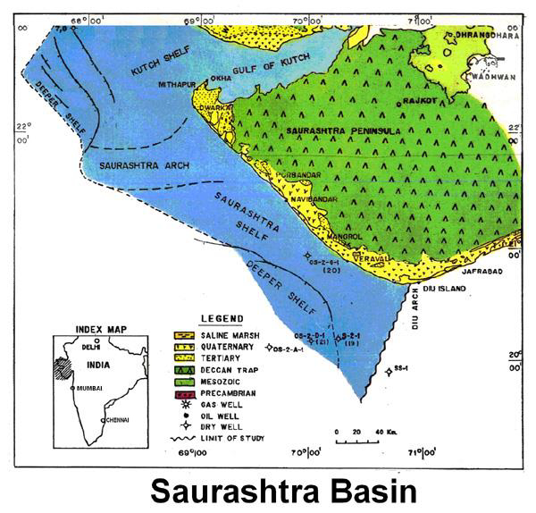
[Figure 1: Index Map of Saurashtra Basin (from dghindia.gov.in)]
Lithology and Thickness
Limestone. Consists of white buff to grey moderately hard mudstone and wackestone, fossiliferous and pyritiferous. In OS-2-G-1, it is 283 m thick and increase further south and westward in deeper shelf.
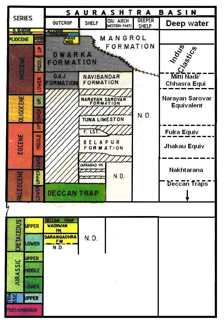
[Figure 2: Generalized Stratigraphy of Saurashtra Basin (from dghindia.gov.in)]
Relationships and Distribution
Lower contact
Lower boundary is unconformable with the Narayan Sarovar Fm. It coincides with the high gamma peak in well OS-2-G-1.
Upper contact
Upper boundary is conformable with the Dwaraka Fm.
Regional extent
GeoJSON
Fossils
M. (L.) droogeri
Age
Depositional setting
Inner shelf.
Additional Information

